
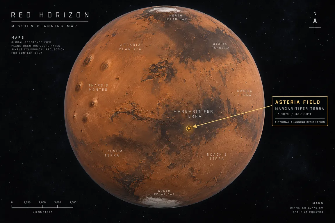
Red Horizon is a fictional, AI-assisted Mars exploration programme, and it now has a name, a purpose, and partners. Ten national programme teams — France, Germany, Estonia, Norway, Spain, Poland, Czechia, Slovakia, Japan, and Canada — have agreed to build a single uncrewed Mars lander and rover together, sharing one mission architecture, one science archive, and one public record.
The purpose is mineralogy and the reconstruction of ancient habitable conditions. Red Horizon One will study how water changed an ancient equatorial landscape in the Margaritifer Terra region, mapping clay-bearing, chloride-bearing, sulfate-bearing, and basaltic units to work out whether that alteration happened in a long-lived lake or groundwater system or in shorter episodic events.
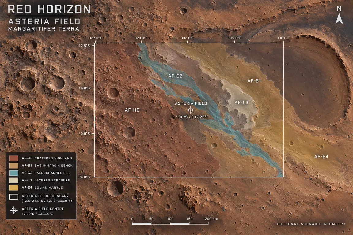
The terrain class is why the region was chosen. Clay and sulfate minerals form in water or are altered by it, so where they appear, and what they sit beside, records what the water was doing and for how long. The mission is aimed at a highland-to-basin transition, where old fractured basement rock, finer sediment laid against a basin margin, and layered deposits lie close enough for one rover to compare altered material with unaltered material. That comparison is what makes a reading of the past testable.
The mission does not search for living organisms or claim evidence of life. Its question is whether the site once offered water, chemistry, energy sources, and environmental stability compatible with life as science understands it.
Margaritifer Terra is a real, officially catalogued region of Mars: an equatorial part of the ancient southern highlands where published geologic mapping records impact craters, valley networks, basin deposits, and mineral evidence of past water activity.
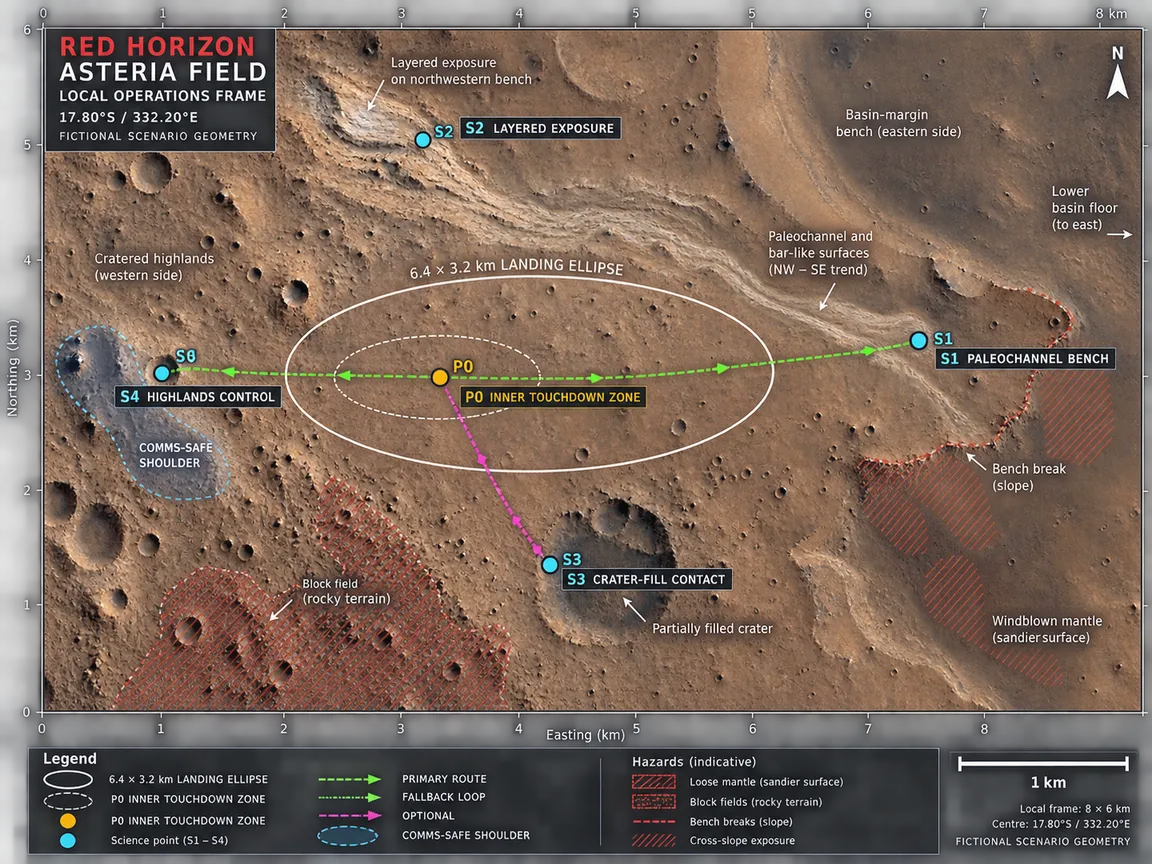
Red Horizon One’s target inside that region is Asteria Field: a fictional Red Horizon operational region designated for mission planning. Its planning centre is 17.80°S, 332.20°E (27.80°W), its planning envelope spans 12.5–24.0°S and 327.0–338.0°E, and the local operations frame is about 8 by 6 kilometres at that centre. These are scenario coordinates chosen to keep mission design consistent. They are not a claim that a real feature sits at that position, and nothing in the programme has established what is present there. The planning plates released with this announcement show that region as it is currently drawn for mission planning.
Governance is equal by design: each partner holds one vote whatever it contributes, and the programme has committed to reporting technical risk and anomalies candidly, not only successes.
The schedule frame is a launch window in 2031. The lifecycle budget frame is €2.10 billion in constant 2026 euros, covering concept work through the final science archive, so the commitment runs beyond the years the rover spends on the surface. The surface mission is designed to operate for two Mars years — 1,374 Earth days — providing at least one full seasonal cycle to characterise an ancient aqueous environment and its mineralogical record. A Mars year is about 687 Earth days, so the surface mission is designed to keep working past its first year.
Technical selections — what the rover carries, who builds what, and how the mission reaches Mars — are still ahead of us.
That is where the public record begins: with a shared objective, a programme, and the practical decisions that turn a mission idea into a testable plan.