
Asteria Field
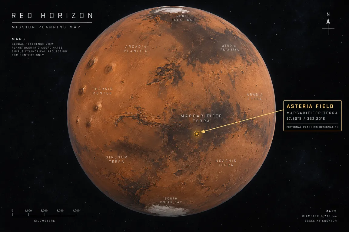
Fictional operational region in Margaritifer Terra that Red Horizon One targets: a compact highland-to-basin transition centred on 17.80°S, 332.20°E.
Red Horizon // fictional Asteria Field planning plates
Control record
| Field | Value |
|---|---|
| Scenario designation | Asteria Field |
| Designation type | Fictional Red Horizon operational region; not an official place name |
| Real parent geography | Margaritifer Terra, Mars |
| Planning centre | 17.80°S, 332.20°E (27.80°W) |
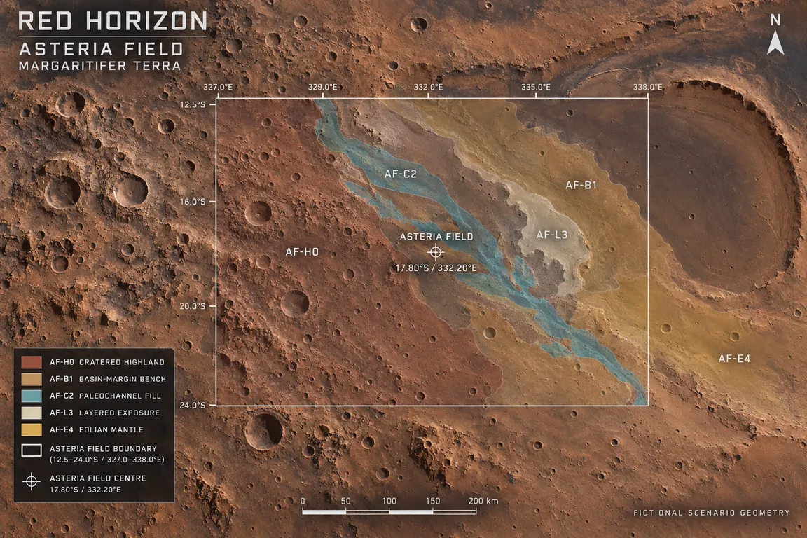
| Planning envelope | 12.5–24.0°S, 327.0–338.0°E |
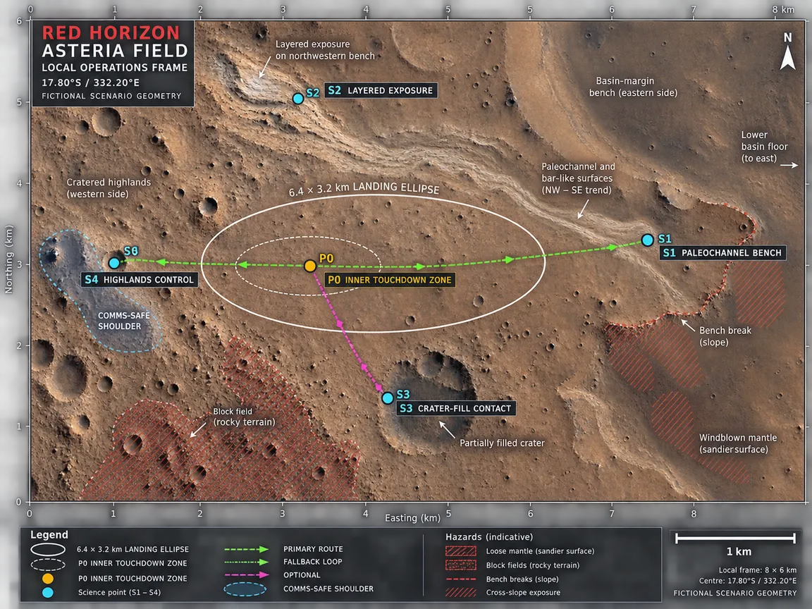
| Local operations frame | 8 × 6 km, centred on the planning centre |
| Working revision | AF-0.2 |
| Released public material | The designation, the planning centre coordinates, the planning envelope, the local operations frame, and planning plates AF-01, AF-02 and AF-03. The rest of the area dossier is not released. |
The planning centre and the envelope are scenario coordinates chosen to keep mission planning consistent. They are not a claim that a named feature sits at that position on Mars.
The real region it sits in
Asteria Field is placed inside Margaritifer Terra, a real, officially catalogued Martian terra. The USGS Gazetteer of Planetary Nomenclature is the authority for that parent name; it does not record Asteria Field.
Published geologic mapping of the region describes ancient cratered highlands, impact-basin structures, valley networks, sedimentary and alluvial deposits, volcanic and tectonic units, and later wind-borne modification (USGS SIM 3209). Mapping of the neighbouring Morava Valles and Margaritifer basin records a long history of fluvial incision, basin sedimentation, possible lacustrine plains, chaotic terrain, and later mass wasting (USGS SIM 3489).
Orbital spectroscopy has identified clay and other hydrated minerals in several Martian regions, and clay and sulfate minerals are useful records of past environmental conditions (NASA Science resource). The mineral targets drawn for Asteria Field borrow that rationale; they do not inherit a confirmed detection.
Scenario boundary
Real Mars geography and Red Horizon scenario design meet at one line, and this page keeps them apart.
Real: Margaritifer Terra itself, and the regional geologic history that published mapping describes. The Gazetteer and the USGS maps are the authority for that material.
Invented for Red Horizon: the name Asteria Field; the planning centre, the planning envelope and the local operations frame; the local mapping units and their labels; and the three planning plates. The plates are original schematic planning graphics generated for the scenario, and they embed no NASA, ESA, USGS, HiRISE, CTX or MOLA imagery.
Asteria Field is not an IAU-approved place name. Nothing here states or implies that a real agency has surveyed, endorsed or adopted the region, and no real institution is a partner in the programme.
Regional setting
Inside the planning envelope, the scenario draws Asteria Field as a compact highland-to-basin transition with three parts: a gently elevated, heavily cratered highland surface to the west; a shallow, arcuate basin-margin depression to the east; and a narrow set of paleochannel benches trending from the north-west toward the south-east. The arrangement is a relationship diagram for mission planning, not a reading of the real local geology.
The three evidence classes
The scenario gives the region three mutually useful classes of material, chosen so that one rover can compare them:
- Cratered basement. Resistant, fractured highland rock with scattered blocky ejecta. It is the baseline for texture and abrasion, and for comparing unaltered rock with altered material.
- Basin-margin material. Laterally persistent, finer-grained layers accumulated against the shallow depression. They test whether fine sediment records transport and aqueous alteration.
- Channel and bench surfaces. Low-relief channel and bar-like ground crossing the other two. They test flow direction, sorting, rounding and contact relationships.
Operational identity
Red Horizon One’s surface rover, RH-01 Pathfinder, is built to map local terrain, inspect rocks in context and establish safe routes. Asteria Field is the scenario’s operating region for that work: the place the mission plans its surface activity in, and the area the three planning plates cover.
The scenario asks the rover to build a chain of evidence rather than to announce a discovery. Orbital context selects the region; surface observations test texture, layering, chemistry and the relationships between the mapped units. Nothing in the scenario claims present water, life or a confirmed mineral detection at Asteria Field, and no target there is described as confirmed clay, confirmed sulfate, habitable or fossil-bearing.
Planning plates
Three plates carry the released visual record of the field: a whole-planet Mars locator, a regional view of the planning envelope, and a local view of the operations frame. They are generated visualizations for scenario planning rather than orbital imagery, and they are the only released visual record of the region. The plates are part of the released record of the project announcement.
Release boundary
The area dossier is a working document, and only part of it is released. Its landing-site geometry, its local mapping units and labels, and its surface-operations planning are not released material, and no part of this page states them. Where the dossier is silent, this page is silent too.