
Red Horizon completes its first mineral-stratigraphy campaign
Red Horizon is a fictional, AI-assisted Mars exploration programme, and the programme has reached the milestone recorded for 18 April 2032. On that date, RH-01 — which landed at Asteria Field on 16 September 2031, as the landing confirmation update recorded, which egressed from its landing platform on 23 September, as the egress update reported, and which collected its first onboard sample on 31 October 2031, as the first sample update confirmed — completed the first mineral-stratigraphy campaign of the mission.
This milestone is the deeper science record the first sample update promised: “Further samples and observations belong to subsequent updates.” It completes the campaign of layered outcrop observations that the first drive update set in motion, and it builds on the released operations model of short, deliberate traverses in which each target is approached, observed, recorded, and then the next safe route chosen.
What stratigraphy means
Stratigraphy is the study of rock layers and the order in which they were laid down. When a rover reads layered outcrops together with mineral and composition data, the combination is called a mineral-stratigraphy campaign: it is an attempt to understand not just what rocks are present, but how they came to be layered in the first place. The Asteria Field entry establishes that layered terrain at the site includes cratered basement, basin-margin material, and channel and bench surfaces — and that the basin-margin layers among them test whether fine sediment records transport and aqueous alteration.
Layered outcrop observations
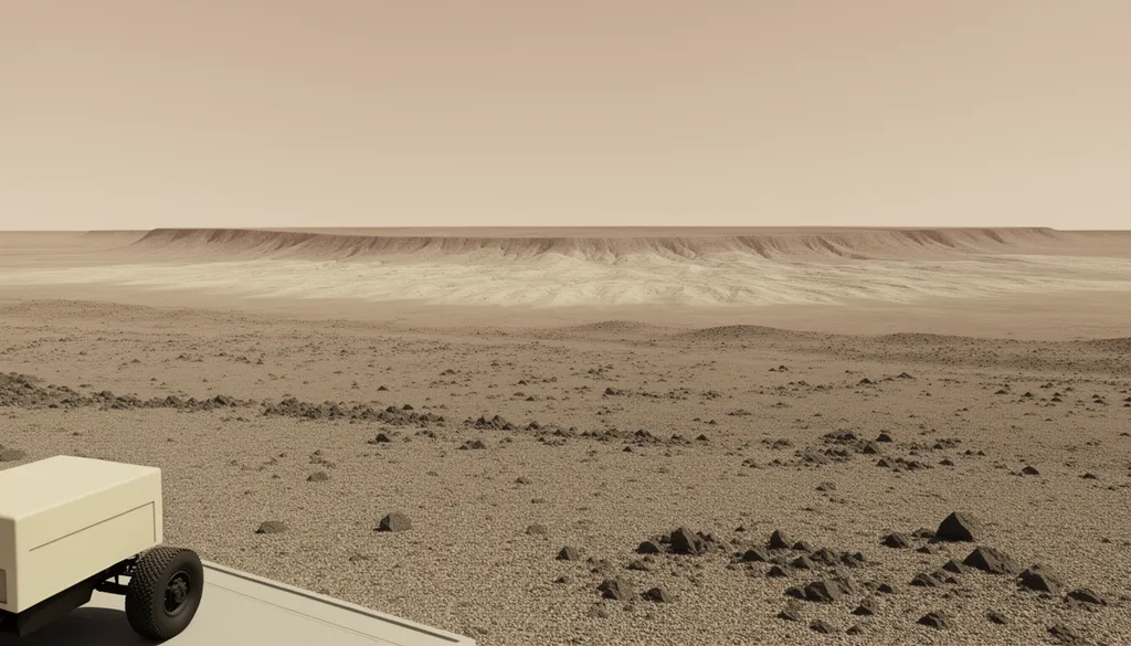
Across the campaign, RH-01 made layered outcrop observations at multiple targets across Asteria Field. A panorama shows where a rock sits in a layered sequence, and the mission used this vocabulary — “layered outcrops”, “layered terrain”, “layers above and below” — to record what the rover saw as it traversed the region. The first surface panorama established that this layered terrain is what the mission would be working in, and the campaign read it in more detail.
The observations are the campaign’s foundation: each target approached, observed, and recorded, with the rover’s contact tool and spectroscopy gathering evidence before any interpretation is made. The RH-01 Pathfinder entry describes the released operations model — it gathers evidence before an interpretation is made — and the campaign followed that model exactly.
A cautious interpretation
The mineral and composition readings from the campaign are consistent with a sedimentary interpretation of the layered sequence: the pattern of layers and the mineral data together point toward a history of deposition and alteration at Asteria Field — the kind of water-lain or alteration history the mission set out to test, as the project announcement described when it defined the mission’s purpose of mapping clay-bearing, chloride-bearing, sulfate-bearing, and basaltic units to work out whether that alteration happened in a long-lived lake or groundwater system or in shorter episodic events.
The interpretation is presented at the cautious level the mission has used throughout: the layered pattern and mineral readings point toward a sedimentary interpretation, and the team is checking the result against further observations. The first sample update established this standing approach — the mineral analysis is presented as what it suggests, not as a final determination — and the campaign follows the same model. NASA Science describes how layered sedimentary rocks on Mars record ancient environments through the same principle: layers are a readable time record. The real-world context grounds the idea that layers are a readable time record; no real mission values are imported into the fictional record.
Stated limitation
The campaign’s interpretation carries a stated limitation: no target at Asteria Field is described as confirmed clay, confirmed sulfate, habitable, or fossil-bearing, and no confirmed mineral detection or confirmed ancient-lake claim is made. The result is one completed campaign of observations checked against further data, leading to a cautious interpretation — not a final determination. The Asteria Field entry establishes the caution ceiling the mission operates under, and the payload selection update records that Red Horizon One is not a life-detection mission and carries no experiment designed to prove that life exists or existed on Mars. The project announcement states that the mission does not search for living organisms or claim evidence of life.
What comes next
The first mineral-stratigraphy campaign is complete, and RH-01 is operating at Asteria Field. The RH-01 Pathfinder entry and the vehicle design update describe the released operations model for what follows: short, deliberate traverses to put instruments in front of the right ground, with each target approached, observed, recorded, and then the next safe route chosen. The Asteria Field entry describes the regional setting in which this work takes place, and the Red Horizon programme entry describes the released framework for the mission overall.
Ariane 64 is a real launcher designation; naming it here says which launcher this fictional mission is planned around, and nothing more. The launch update records the mission’s departure aboard it. Its record belongs to the organisations that build and operate it, and no real agency, launcher operator, or launch facility is a partner in this programme or has endorsed or approved it. The Red Horizon programme entry describes the released framework for this mission.
Red Horizon is a fictional, AI-assisted Mars exploration programme. The real-world sources cited on the payload selection update describe the general class of technique this mission employs; no real institution is a partner in Red Horizon, and none of them has endorsed or approved it.